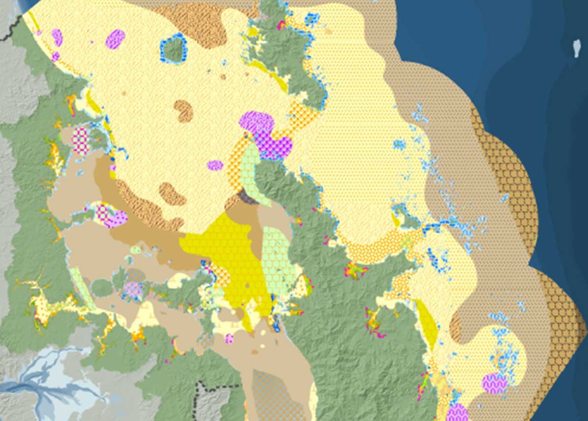
The proposed marine spatial plan would add a further 15 new marine protected areas to the marine park.
These include no-take marine reserves to extend existing reserves near Leigh and Hahei, to protect crayfish within their home ranges; an area around Otata island in the Noises islands, an area under heavy recreational fishing use; around education destination Rotoroa island; a quadrant of the coast around Hauturu – Little Barrier island; as well as areas near Cape Colville – Moehau, the Motukawao Group off western Coromandel and Slipper Island – Whakahau.
It has also identified options for marine protection – in Kawau Bay, Tiritiri Matangi, Rangitoto-Motutapu, Mokohinau, Whangateau Harbour and Alderman islands – Te Ruamaahua – plus a benthic protection area at the Mercury Islands – Ahuahu.
The plan envisages further identification of representative and ecologically important areas for marine protection by 2018
It identifies design and management principles for new marine reserves, including provision for cultural harvest and a generational review after 25 years.
The plan also seeks to restore ecosystem function through active restoration of mussel reefs, shellfish beds and seagrass meadows.
This would scale up work by groups such as Revive our Gulf, which has reintroduced mussels to former areas. It envisages a regulatory framework that enables easier transfer of shellfish and conditioning of suitable habitat. A proposed restoration initiative would involve close links with mana whenua and industry.
The plan aims to restore historic ecosystem functionality of bivalve beds by 2040 to recover self-sustaining, expanding, filtering capacity and secondary production.
A benthic protection area over the Firth of Thames is proposed to support the regeneration of mussel beds.
The full text of the Sea Change – Tai Timu Tai Pari marine spatial plan is available here.